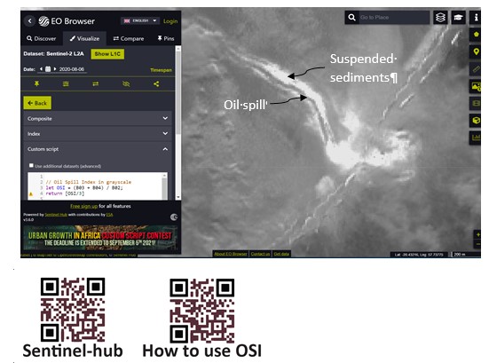
Oil spill incidents occur due to various reasons and contaminate the water body and forming oil sludge in the sea and along the coast. The oil spill affects severely the seagrasses, coral reefs, aquaculture, desalination plants, etc. in the marine environment and affects the economy of the areas including tourism activities. In this context, the Environmental Science Center (ESC), Qatar University researched the oil spills of Mauritius (August 06, 2020) and Norilsk (May 29, 2020) using Sentinel data of the European Space Agency (ESA) joining with a research team from the University of Mauritius (Mauritius), Sultan Qaboos University (Oman), State Hydrological Institute (Russia), and National Institute of Technology (India).
The team developed an oil spill index to Sentinel-2 optical satellite data to map oil spills of the marine environment (https://www.sciencedirect.com/science/article/pii/S0269749121001962?via%3Dihub, https://www.sciencedirect.com/science/article/pii/S2215016121001205?via%3Dihub, https://www.nature.com/articles/s41598-021-83260-7,) and the indices are online in the Sentinel-hub now as Oil Spill Index (OSI) https://custom-scripts.sentinel-hub.com/sentinel-2/oil-spill-index/. The site links the EO browser (Earth Observation browser) to map oil spills of the area interested using the indices in the global data by selecting the date of oil spill incident for research scientists worldwide. The OSI index is the first to Sentinel-2 optical data of ESA (European Space Agency) to map oil spills.